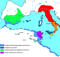
File:Carthaginianempire.PNG

Yanayin wannan rigayi gani: 639 × 600 pixels. Wasu yarjejeniyoyi: 256 × 240 pixels | 511 × 480 pixels | 818 × 768 pixels | 1,091 × 1,024 pixels | 2,424 × 2,276 pixels.
Hoton asali (pikisal 2,424 × 2,276, girman fayil: 65 KB, irin MIME: image/png)
Tarihin fayil
Ku latsa rana/lokaci ku ga fayil yadda yake a wannan lokaci
| Rana/Lokaci | Wadar sufa | Kusurwowi | Ma'aikaci | Bahasi | |
|---|---|---|---|---|---|
| na yanzu | 13:01, 8 Mayu 2020 |  | 2,424 × 2,276 (65 KB) | German0706 | Size optimized with ECT (Efficient-Compression-Tool)and pingo (css-ig.net) |
| 17:04, 11 Disamba 2014 |  | 2,424 × 2,276 (94 KB) | OgreBot | (BOT): Uploading old version of file from en.wikipedia; originally uploaded on 2014-09-19 17:06:29 by Daygum | |
| 17:04, 11 Disamba 2014 |  | 2,424 × 2,276 (217 KB) | OgreBot | (BOT): Uploading old version of file from en.wikipedia; originally uploaded on 2008-07-15 13:08:27 by Javierfv1212 | |
| 14:46, 4 Nuwamba, 2011 |  | 639 × 600 (176 KB) | Javierfv1212 | Reverted to version as of 14:22, 27 November 2008 | |
| 14:03, 4 Nuwamba, 2011 |  | 1,583 × 869 (365 KB) | Javierfv1212 | I completely redid the map, it's better aesthetically and also more accurate. Now includes more accurate Carthaginian holdings in Spain, cities and landmarks in Italy and expanded eastwards to Greece. Sources: Cambridge Ancient History Vol 8. Rome & the M | |
| 14:22, 27 Nuwamba, 2008 |  | 639 × 600 (176 KB) | Dorieo | {{Information |Description={{en|Carthaginian empire through the Punic wars}} |Source=Transferred from [http://en.wikipedia.org en.wikipedia]; transfer was stated to be made by User:Dorieo.<br/> (Original text : ''I created this work entirely by myself |
Amfani da fayil
Wadannan shafi na amfani wannan fayil:
Amfanin fayil a ko'ina
Wadannan sauran wikis suna amfani da fayil din anan
- Amfani a kan arz.wikipedia.org
- Amfani a kan ast.wikipedia.org
- Amfani a kan az.wikipedia.org
- Amfani a kan bg.wikipedia.org
- Amfani a kan ca.wikipedia.org
- Amfani a kan cs.wikipedia.org
- Amfani a kan da.wikipedia.org
- Amfani a kan el.wikipedia.org
- Amfani a kan en.wikipedia.org
- Amfani a kan es.wikibooks.org
- Amfani a kan et.wikipedia.org
- Amfani a kan eu.wikipedia.org
- Amfani a kan fr.wikipedia.org
- Amfani a kan fy.wikipedia.org
- Amfani a kan he.wikipedia.org
- Amfani a kan hu.wikipedia.org
- Amfani a kan hy.wikipedia.org
- Amfani a kan is.wikipedia.org
- Amfani a kan ja.wikipedia.org
- Amfani a kan ka.wikipedia.org
- Amfani a kan ko.wikipedia.org
- Amfani a kan la.wikipedia.org
- Amfani a kan lfn.wikipedia.org
- Amfani a kan ml.wikipedia.org
Duba ƙarin amfanin wannan fayil.
