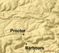
Fayil:Plunketts Creek Relief Map.PNG

Yanayin wannan rigayi gani: 664 × 600 pixels. Wasu yarjejeniyoyi: 266 × 240 pixels | 532 × 480 pixels | 886 × 800 pixels.
Hoton asali (pikisal 886 × 800, girman fayil: 107 KB, irin MIME: image/png)
Tarihin fayil
Ku latsa rana/lokaci ku ga fayil yadda yake a wannan lokaci
| Rana/Lokaci | Wadar sufa | Kusurwowi | Ma'aikaci | Bahasi | |
|---|---|---|---|---|---|
| na yanzu | 00:07, 5 ga Afirilu, 2013 |  | 886 × 800 (107 KB) | Ruhrfisch | Add labels for Barbours and Proctor, all other info the same |
| 00:02, 5 ga Afirilu, 2013 |  | 886 × 800 (107 KB) | Ruhrfisch | Add labels for Barbours and Proctor, all other info the same | |
| 00:01, 5 ga Afirilu, 2013 |  | 886 × 800 (107 KB) | Ruhrfisch | Add labels for Barbours and Proctor, all other info the same | |
| 05:07, 15 ga Yuli, 2008 |  | 885 × 800 (134 KB) | Jarekt | {{Information |Description=Cropped watermark |Source= |Date= |Author= |Permission= |other_versions= }} | |
| 02:31, 13 ga Augusta, 2007 |  | 905 × 800 (141 KB) | Ruhrfisch | {{Information| |Description= Relief Map of Plunketts Creek Watershed in Lycoming and Sullivan Counties, Pennsylvania, United States |Source= This is a section of a map taken from the planiglobe website [http://www.planiglobe.com/omc_set.html] and enlarge |
Amfani da fayil
Wadannan shafi na amfani wannan fayil:
Amfanin fayil a ko'ina
Wadannan sauran wikis suna amfani da fayil din anan
- Amfani a kan en.wikipedia.org
- Amfani a kan te.wikipedia.org
- Amfani a kan zh.wikipedia.org
