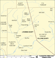
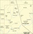
Fayil:Plunketts Creek Map.PNG

Yanayin wannan rigayi gani: 564 × 599 pixels. Wasu yarjejeniyoyi: 226 × 240 pixels | 611 × 649 pixels.
Hoton asali (pikisal 611 × 649, girman fayil: 30 KB, irin MIME: image/png)
Tarihin fayil
Ku latsa rana/lokaci ku ga fayil yadda yake a wannan lokaci
| Rana/Lokaci | Wadar sufa | Kusurwowi | Ma'aikaci | Bahasi | |
|---|---|---|---|---|---|
| na yanzu | 02:55, 26 Satumba 2007 |  | 611 × 649 (30 KB) | Ruhrfisch | Added source (pond) based on PennDOT Sullivan County map at[ftp://ftp.dot.state.pa.us/public/pdf/BPR_pdf_files/Maps/GHS/Roadnames/sullivan_GHSN.PDF] ~~~~ |
| 02:38, 25 Satumba 2007 |  | 611 × 649 (30 KB) | Ruhrfisch | Added scale (miles and kilometers) and label at bottom, all other information is the same ~~~~ | |
| 16:56, 14 Satumba 2007 |  | 611 × 620 (28 KB) | Ruhrfisch | Adjust dot for Barbours, one pixel fixed on Wolf Run course, all other information the same | |
| 23:12, 11 ga Augusta, 2007 |  | 611 × 620 (28 KB) | Ruhrfisch | Fixed spelling of Reibsan Run, all other iformation the same as previous versions. | |
| 02:40, 11 ga Augusta, 2007 |  | 611 × 620 (28 KB) | Ruhrfisch | Add village of Hillsgrove as mentioned in article, shifted map east a bit. All other info the same. | |
| 04:07, 10 ga Augusta, 2007 |  | 575 × 620 (25 KB) | Ruhrfisch | {{Information| |Description= Map of Plunketts Creek in Lycoming and Sullivan Counties, Pennsylvania, United States |Source= taken from US Census website [http://factfinder.census.gov/] and modified by User:Ruhrfisch. |Date= August 2007 |Author= US C |
Amfani da fayil
Wadannan shafi na amfani wannan fayil:
Amfanin fayil a ko'ina
Wadannan sauran wikis suna amfani da fayil din anan
- Amfani a kan bn.wikipedia.org
- Amfani a kan en.wikipedia.org
- Amfani a kan ko.wikipedia.org
- Amfani a kan te.wikipedia.org
- Amfani a kan zh.wikipedia.org

