Fayil:Kraje Slovenska.svg

Size of this PNG preview of this SVG file: 800 × 390 pixels. Wasu yarjejeniyoyi: 320 × 156 pixels | 640 × 312 pixels | 1,024 × 499 pixels | 1,280 × 623 pixels | 2,560 × 1,246 pixels | 953 × 464 pixels.
Hoton asali (Fayil kin SVG, saƙar fikisal 953 x 464, girman fayil: 376 KB)
Taƙaici
| Bayani |
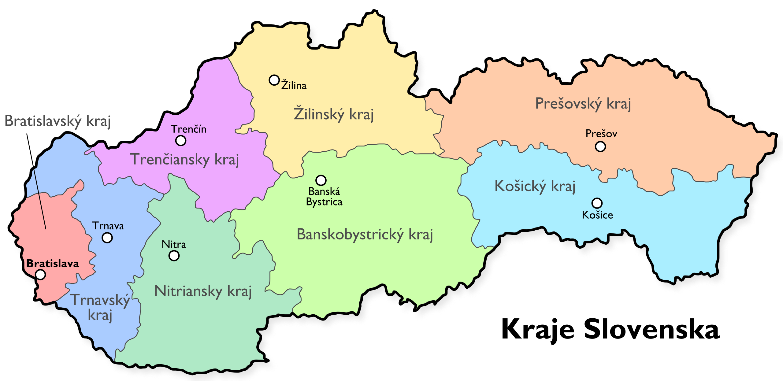
English: Map of the Regions of Slovakia. |
| Masomi | Aikin na |
| Marubucin | User:Mortadelo2005 |
| Other versions |
|


This W3C-unspecified vector image was created with Inkscape .
Lasisi
| I, the copyright holder of this work, release this work into the public domain. This applies worldwide. In some countries this may not be legally possible; if so: I grant anyone the right to use this work for any purpose, without any conditions, unless such conditions are required by law. |
Tarihin fayil
Ku latsa rana/lokaci ku ga fayil yadda yake a wannan lokaci
| Rana/Lokaci | Wadar sufa | Kusurwowi | Ma'aikaci | Bahasi | |
|---|---|---|---|---|---|
| na yanzu | 18:29, 20 Mayu 2007 | | 953 × 464 (376 KB) | Mortadelo2005 | {{Information |Description=Map of the regions of Slovakia. |Source= |Date= |Author=User:Mortadelo2005 |Permission= |other_versions= }} {{Created with Inkscape}} Category:Administrative units of Slovakia |
Amfani da fayil
Wadannan shafi na amfani wannan fayil:
Amfanin fayil a ko'ina
Wadannan sauran wikis suna amfani da fayil din anan
- Amfani a kan af.wikipedia.org
- Amfani a kan ar.wikipedia.org
- Amfani a kan azb.wikipedia.org
- Amfani a kan cs.wikipedia.org
- Amfani a kan de.wikipedia.org
- Amfani a kan el.wikipedia.org
- Amfani a kan eo.wikipedia.org
- Amfani a kan fr.wikipedia.org
- Amfani a kan id.wikipedia.org
- Amfani a kan lez.wikipedia.org
- Amfani a kan nl.wikipedia.org
- Amfani a kan no.wikipedia.org
- Amfani a kan rm.wikipedia.org
- Amfani a kan ro.wikipedia.org
- Amfani a kan rue.wikipedia.org
- Amfani a kan sk.wikipedia.org
- Amfani a kan sl.wikipedia.org
- Amfani a kan sr.wikipedia.org
- Amfani a kan zh-min-nan.wikipedia.org