Fayil:Tarrant County Texas Incorporated Areas Fort Worth highlighted.svg

Size of this PNG preview of this SVG file: 800 × 436 pixels. Wasu yarjejeniyoyi: 320 × 175 pixels | 640 × 349 pixels | 1,024 × 559 pixels | 1,280 × 698 pixels | 2,560 × 1,396 pixels.
Hoton asali (Fayil kin SVG, saƙar fikisal 1,100 x 600, girman fayil: 235 KB)
Taƙaici
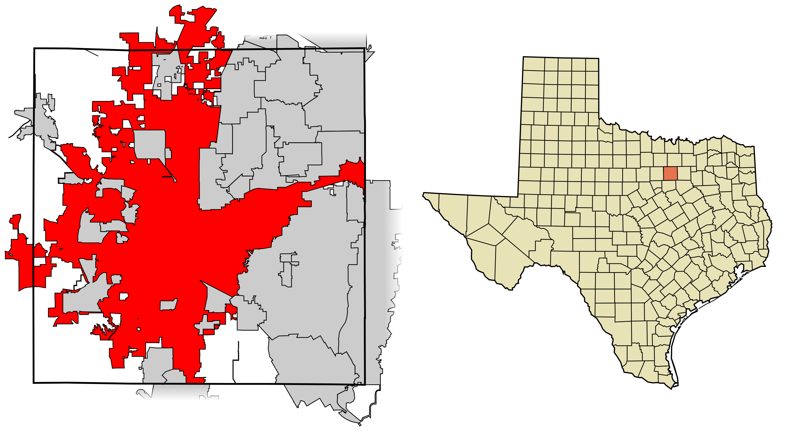
| Bayani | This map shows the incorporated areas in Tarrant County, Texas. Fort Worth is highlighted in red. I created it in Inkscape using data from the following links: North Central Texas Council of Governments Maps Website, City of Fort Worth Interactive Zoning Map |
| Rana | |
| Masomi | My own work, based on government information. Though I strove to be as accurate in the detail as possible, the information shown is not guaranteed to be completely accurate. |
| Marubucin | Ixnayonthetimmay |
| Izini (Sake amfani da wannan fayil) |
Public Domain |
| Other versions | See Category:Maps of Tarrant County, Texas for other versions of this image. |
Lasisi
| I, the copyright holder of this work, release this work into the public domain. This applies worldwide. In some countries this may not be legally possible; if so: I grant anyone the right to use this work for any purpose, without any conditions, unless such conditions are required by law. |
Tarihin fayil
Ku latsa rana/lokaci ku ga fayil yadda yake a wannan lokaci
| Rana/Lokaci | Wadar sufa | Kusurwowi | Ma'aikaci | Bahasi | |
|---|---|---|---|---|---|
| na yanzu | 05:44, 31 ga Augusta, 2007 | | 1,100 × 600 (235 KB) | Ixnayonthetimmay | |
| 02:29, 29 ga Augusta, 2007 |  | 1,100 × 600 (235 KB) | Ixnayonthetimmay | == Summary == {{Information |Description=This map shows the incorporated areas in Tarrant County, Texas. Fort Worth is highlighted in red. I created it in [[en:Inkscape |
Amfani da fayil
Wadannan shafi na amfani wannan fayil:
Amfanin fayil a ko'ina
Wadannan sauran wikis suna amfani da fayil din anan
- Amfani a kan af.wikipedia.org
- Amfani a kan ang.wikipedia.org
- Amfani a kan ar.wikipedia.org
- Amfani a kan arz.wikipedia.org
- Amfani a kan ast.wikipedia.org
- Amfani a kan bn.wikipedia.org
- Amfani a kan br.wikipedia.org
- Amfani a kan ca.wikipedia.org
- Amfani a kan ceb.wikipedia.org
- Amfani a kan de.wikipedia.org
- Amfani a kan el.wikipedia.org
- Amfani a kan en.wikipedia.org
- Amfani a kan eo.wikipedia.org
- Amfani a kan et.wikipedia.org
- Amfani a kan eu.wikipedia.org
- Amfani a kan fa.wikipedia.org
- Amfani a kan fi.wikipedia.org
- Amfani a kan fo.wikipedia.org
- Amfani a kan fr.wikipedia.org
- Amfani a kan fy.wikipedia.org
- Amfani a kan ga.wikipedia.org
- Amfani a kan gd.wikipedia.org
- Amfani a kan gl.wikipedia.org
- Amfani a kan he.wikipedia.org
- Amfani a kan ht.wikipedia.org
- Amfani a kan hu.wikipedia.org
- Amfani a kan ia.wikipedia.org
- Amfani a kan is.wikipedia.org
- Amfani a kan it.wikipedia.org
- Amfani a kan ja.wikipedia.org
- Amfani a kan ko.wikipedia.org
- Amfani a kan ku.wikipedia.org
- Amfani a kan kw.wikipedia.org
- Amfani a kan la.wikipedia.org
- Amfani a kan ml.wikipedia.org
- Amfani a kan ms.wikipedia.org
- Amfani a kan nl.wikipedia.org
- Amfani a kan nn.wikipedia.org
- Amfani a kan pa.wikipedia.org
- Amfani a kan pnb.wikipedia.org
- Amfani a kan pt.wikipedia.org
- Amfani a kan qu.wikipedia.org
- Amfani a kan ro.wikipedia.org
- Amfani a kan sco.wikipedia.org
- Amfani a kan sc.wikipedia.org
- Amfani a kan simple.wikipedia.org
- Amfani a kan sk.wikipedia.org
- Amfani a kan sl.wikipedia.org
Duba ƙarin amfanin wannan fayil.