File:Pra River.gif
Babu wata babbar saƙa.
Pra_River.gif (pikisal 564 × 599, girman fayil: 117 KB, irin MIME: image/gif, looped, 3 frames, Daƙiƙa 0.3)
Taƙaici
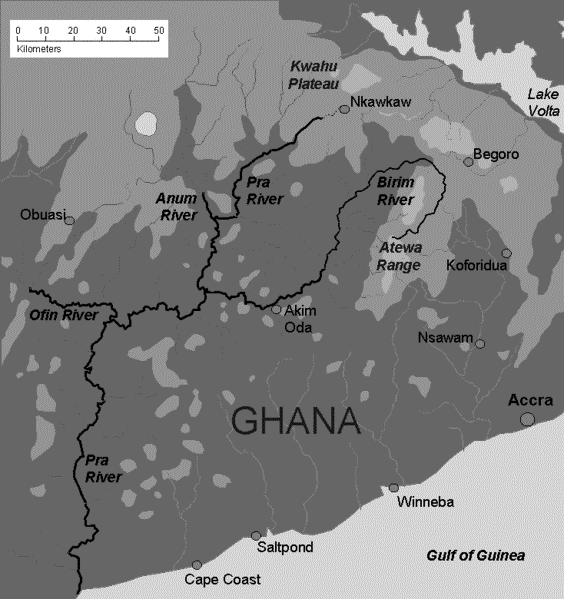
| Bayani | Sketch map of Pra river in Ghana and tributaries |
| Rana | |
| Masomi | Aikin na |
| Marubucin | Aymatth2 |
Lasisi
| I, the copyright holder of this work, release this work into the public domain. This applies worldwide. In some countries this may not be legally possible; if so: I grant anyone the right to use this work for any purpose, without any conditions, unless such conditions are required by law. |
Tarihin fayil
Ku latsa rana/lokaci ku ga fayil yadda yake a wannan lokaci
| Rana/Lokaci | Wadar sufa | Kusurwowi | Ma'aikaci | Bahasi | |
|---|---|---|---|---|---|
| na yanzu | 21:53, 29 Nuwamba, 2012 | | 564 × 599 (117 KB) | Ciaurlec | Desaturated to make topography more readble. |
| 02:13, 22 ga Maris, 2009 |  | 734 × 780 (28 KB) | Aymatth2 | {{Information |Description=Sketch map of Pra river in Ghana and tributaries |Source=self-made |Date=2009-03-20 |Author= Aymatth2 |Permission= |other_versions= }} Category:Geological maps |
Amfani da fayil
Wadannan 2 shafuka suna amfani wannan fayil:
Amfanin fayil a ko'ina
Wadannan sauran wikis suna amfani da fayil din anan
- Amfani a kan ast.wikipedia.org
- Amfani a kan cv.wikipedia.org
- Amfani a kan en.wikipedia.org
- Amfani a kan es.wikipedia.org
- Amfani a kan fr.wikipedia.org
- Amfani a kan lt.wikipedia.org
- Amfani a kan pl.wikipedia.org
- Amfani a kan ru.wikipedia.org
- Amfani a kan simple.wikipedia.org
- Amfani a kan zh.wikipedia.org