File:Mount Bonnell 2008.jpg
Yanayin wannan rigayi gani: 800 × 600 pixels. Wasu yarjejeniyoyi: 320 × 240 pixels | 640 × 480 pixels | 1,024 × 768 pixels | 1,280 × 960 pixels | 2,560 × 1,920 pixels | 2,816 × 2,112 pixels.
Hoton asali (pikisal 2,816 × 2,112, girman fayil: 2.61 MB, irin MIME: image/jpeg)
Taƙaici
| Bayani |
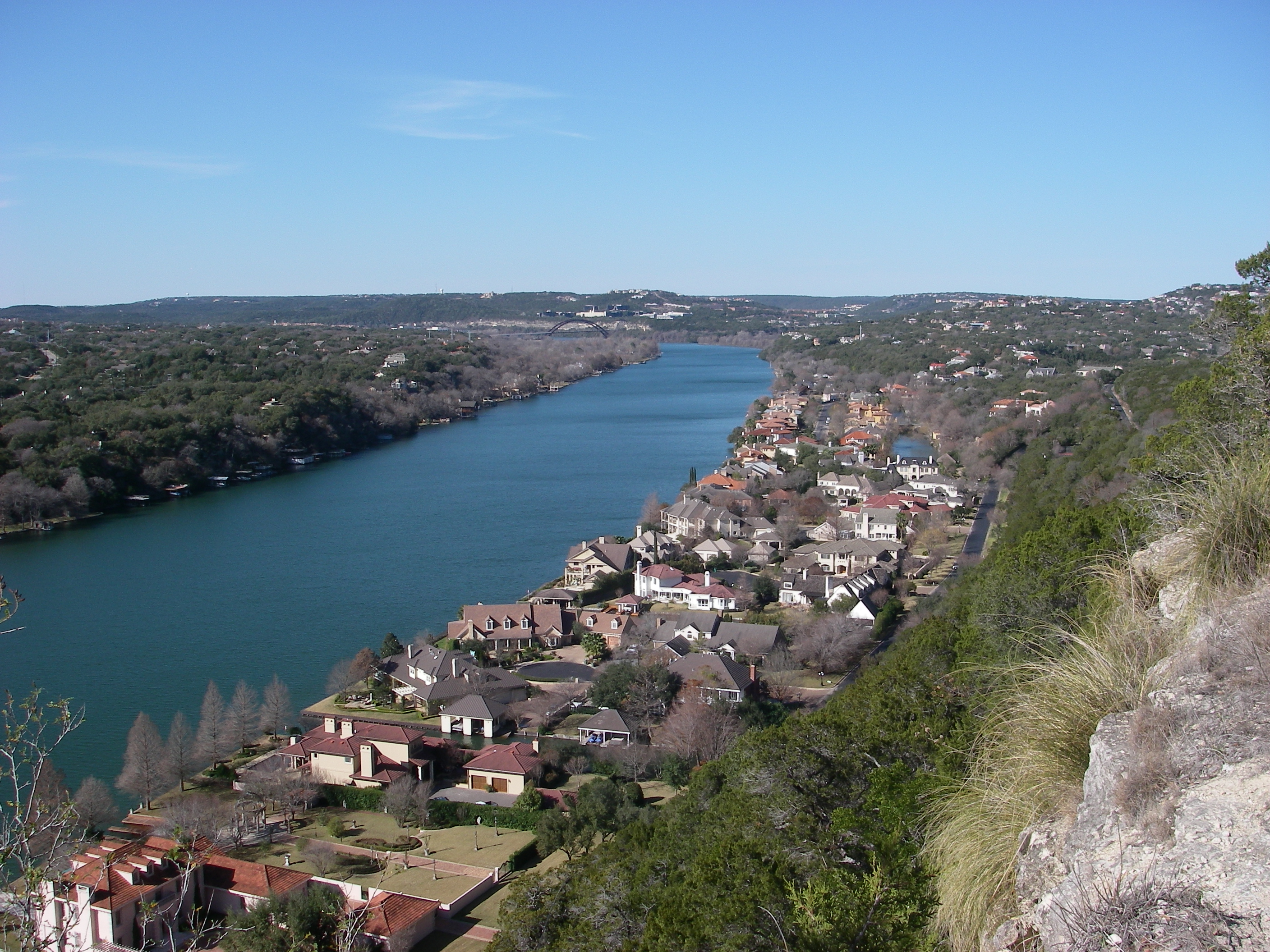
English: View from atop Mount Bonnell looking northwest toward Pennybacker Bridge in Austin, Texas. |
| Rana | |
| Masomi | Aikin na |
| Marubucin | Leaflet |
| Other versions | Public domain photos of the Rolling Plains of Texas. |
| Camera location | | View this and other nearby images on: OpenStreetMap |
|---|
Lasisi
| I, the copyright holder of this work, release this work into the public domain. This applies worldwide. In some countries this may not be legally possible; if so: I grant anyone the right to use this work for any purpose, without any conditions, unless such conditions are required by law. |
Tarihin fayil
Ku latsa rana/lokaci ku ga fayil yadda yake a wannan lokaci
| Rana/Lokaci | Wadar sufa | Kusurwowi | Ma'aikaci | Bahasi | |
|---|---|---|---|---|---|
| na yanzu | 05:26, 15 ga Faburairu, 2009 | | 2,816 × 2,112 (2.61 MB) | Leaflet | {{Information |Description={{en|1=View from atop Mount Bonnell looking northwest toward Pennybacker Bridge.}} |Source=Own work by uploader |Author=Leaflet |Date=December 31, 2008 |Permission= |other_versions= }} <!--{{ImageUpload|full}}- |
Amfani da fayil
Wadannan shafi na amfani wannan fayil:
Amfanin fayil a ko'ina
Wadannan sauran wikis suna amfani da fayil din anan
- Amfani a kan af.wikipedia.org
- Amfani a kan arz.wikipedia.org
- Amfani a kan be.wikipedia.org
- Amfani a kan bn.wikipedia.org
- Amfani a kan cs.wikipedia.org
- Amfani a kan cv.wikipedia.org
- Amfani a kan da.wikipedia.org
- Amfani a kan en.wikipedia.org
- Amfani a kan eo.wikipedia.org
- Amfani a kan fi.wikipedia.org
- Amfani a kan fi.wiktionary.org
- Amfani a kan fr.wikipedia.org
- Amfani a kan hu.wikipedia.org
- Amfani a kan hy.wikipedia.org
- Amfani a kan ia.wikipedia.org
- Amfani a kan id.wikipedia.org
- Amfani a kan ja.wikipedia.org
- Amfani a kan lt.wikipedia.org
- Amfani a kan no.wikipedia.org
- Amfani a kan pt.wikipedia.org
- Amfani a kan ru.wikipedia.org
- Amfani a kan sd.wikipedia.org
- Amfani a kan sh.wikipedia.org
- Amfani a kan www.wikidata.org
- Amfani a kan xmf.wikipedia.org
- Amfani a kan zh.wikipedia.org