File:Indian Ocean-CIA WFB Map.png
Babu wata babbar saƙa.
Indian_Ocean-CIA_WFB_Map.png (pikisal 330 × 330, girman fayil: 11 KB, irin MIME: image/png)

|
This locator map image could be re-created using vector graphics as an SVG file. This has several advantages; see Commons:Media for cleanup for more information. If an SVG form of this image is available, please upload it and afterwards replace this template with
{{vector version available|new image name}}.
It is recommended to name the SVG file “Indian Ocean-CIA WFB Map.svg”—then the template Vector version available (or Vva) does not need the new image name parameter. |
Taƙaici
| Bayani |
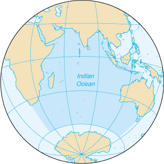
English: Map of The Indian Ocean with English captions. |
|||
| Rana | ||||
| Masomi | The World Factbook | |||
| Marubucin | United States Central Intelligence Agency | |||
| Izini (Sake amfani da wannan fayil) |
|
|||
| Other versions |
|


Derivative works
Derivative works of this file: Samudra Hindia.png
Tarihin fayil
Ku latsa rana/lokaci ku ga fayil yadda yake a wannan lokaci
| Rana/Lokaci | Wadar sufa | Kusurwowi | Ma'aikaci | Bahasi | |
|---|---|---|---|---|---|
| na yanzu | 09:14, 27 ga Maris, 2005 | | 330 × 330 (11 KB) | Wolfman~commonswiki | {{CIA-map}} |
Amfani da fayil
Wadannan shafi na amfani wannan fayil:
Amfanin fayil a ko'ina
Wadannan sauran wikis suna amfani da fayil din anan
- Amfani a kan am.wikipedia.org
- Amfani a kan ang.wikipedia.org
- Amfani a kan anp.wikipedia.org
- Amfani a kan as.wikipedia.org
- Amfani a kan azb.wikipedia.org
- Amfani a kan ba.wikipedia.org
- Amfani a kan be.wikipedia.org
- Amfani a kan bg.wikipedia.org
- Amfani a kan bh.wikipedia.org
- Amfani a kan bjn.wikipedia.org
- Amfani a kan blk.wikipedia.org
- Amfani a kan cdo.wikipedia.org
- Amfani a kan ckb.wikipedia.org
- Amfani a kan co.wikipedia.org
- Amfani a kan cs.wikipedia.org
- Amfani a kan dty.wikipedia.org
- Amfani a kan el.wikipedia.org
- Amfani a kan en.wikipedia.org
- Amfani a kan en.wikibooks.org
- Amfani a kan en.wikinews.org
- Amfani a kan en.wikisource.org
- Amfani a kan en.wikiversity.org
- Amfani a kan en.wiktionary.org
- Amfani a kan fa.wikipedia.org
- Amfani a kan fo.wikipedia.org
- Amfani a kan gor.wikipedia.org
- Amfani a kan gu.wikipedia.org
- Amfani a kan gv.wikipedia.org
- Amfani a kan hak.wikipedia.org
- Amfani a kan he.wikipedia.org
- Amfani a kan hi.wikipedia.org
- Amfani a kan hu.wikipedia.org
- Amfani a kan id.wikipedia.org
Duba ƙarin amfanin wannan fayil.