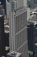
Fayil:Chase Tower, Looking Northeast from Willis Tower Skydeck, Chicago, Illinois (9179387641).jpg

Hoton asali (pikisal 4,000 × 3,000, girman fayil: 3.05 MB, irin MIME: image/jpeg)
Wannan hoto yazo daga Wikimedia Commons kuma za'a iya amfani dashi a wasu projects. Anan kasa an nuna asalin bayanin shi
Taƙaici
| BayaniChase Tower, Looking Northeast from Willis Tower Skydeck, Chicago, Illinois (9179387641).jpg |
Chase Tower, located in the Chicago Loop area of Chicago at 10 South Dearborn Street, is a 60 story skyscraper completed in 1969. At 850 feet (259 m) tall, it is the tenth tallest building in Chicago, the tallest building inside the Chicago 'L' Loop elevated tracks, and the 32nd tallest in the United States. Chase Bank has its U.S. and Canada commercial and retail banking headquarters here. The building is also the headquarters of Exelon. The building and its plaza (known as Exelon Plaza) occupy the entire block bounded by Clark, Dearborn, Madison, and Monroe Streets. The building first opened in 1969 as First National Plaza. When constructed, it was the headquarters of First Chicago Corporation. In 1998, it became the headquarters for Bank One Corporation, and accordingly it was renamed Bank One Tower. The current name dates from October 24, 2005, after Bank One merged with Chase. Design architects for the construction were C.F. Murphy Associates, Stanislaw Z. Gladych and Perkins and Will. Chase Tower is known for both its distinctive curving shape and its vibrant public space: a deep sunken plaza at the geographic center of the Chicago Loop, complete with a jet fountain and Marc Chagall's ceramic wall mural Four Seasons. en.wikipedia.org/wiki/Chase_Tower_(Chicago) en.wikipedia.org/wiki/Wikipedia:Text_of_Creative_Commons_... |
|||
| Rana | ||||
| Masomi | Chase Tower, Looking Northeast from Willis Tower Skydeck, Chicago, Illinois | |||
| Marubucin | Ken Lund from Reno, Nevada, USA | |||
| Other versions |
|
| Camera location | 41° 52′ 44.12″ N, 87° 38′ 09.36″ W | View this and other nearby images on: OpenStreetMap |
|---|
Lasisi
- Za ka iya:
- a raba – dan kwafa, yadawa da aika aikin
- dan maimaita – dan daukar aikin
- A karkashin wannan sharuddan
- Jinginarwa – Dole ku bada jinjina da ta dace, samar da linki zuwa lasisin, da kuma bayyana ko kunyi sauyi. Zaku iya haka ta yadda ta dace, amma ba kowace hanya ba wanda zai nuna mai-lasisin yana goyon bayan ku ba ko goyon bayan amfanin da kuke yi ba.
- Yada ahaka – Idan kuka maimaita, sabuntawa, ko kari akan wannan, dole ku bayar da gudunmuwar ku karkashin iri daya ko lasisi data dace kamar na asali.
| This image was originally posted to Flickr by Ken Lund at https://flickr.com/photos/75683070@N00/9179387641. It was reviewed on 2 Maris 2017 by FlickreviewR and was confirmed to be licensed under the terms of the cc-by-sa-2.0. |
2 Maris 2017
Take
Abubuwan da aka nuna a cikin wannan fayil
depicts Turanci
Wasu muhimman ba tare da Wikidata kayayyaki ba
copyright status Turanci
copyrighted Turanci
coordinates of the point of view Turanci
41°52'44.123"N, 87°38'9.359"W
captured with Turanci
Canon PowerShot SX130 IS Turanci
27 Yuni 2013
media type Turanci
image/jpeg
checksum Turanci
ca6e3b74d440d6b8799620fd89d123725e58a0a9
data size Turanci
3,199,690 byte
height Turanci
3,000 pixel
width Turanci
4,000 pixel
Tarihin fayil
Ku latsa rana/lokaci ku ga fayil yadda yake a wannan lokaci
| Rana/Lokaci | Wadar sufa | Kusurwowi | Ma'aikaci | Bahasi | |
|---|---|---|---|---|---|
| na yanzu | 02:43, 2 ga Maris, 2017 |  | 4,000 × 3,000 (3.05 MB) | Victorgrigas | Transferred from Flickr via Flickr2Commons |
Amfani da fayil
Babu shafuka da suke amfani da fayil din nan.
bayannan meta
Wannan fayil ya ƙumshi ƙarin bayani daga kyamarar dijita ko sikanan da aka yi amfani da su.
Idan an sauya fayil kin, to wasu bayannan na ainahi ba za su fito ba sosai a cikin sabon fayil kin.
| Camera manufacturer | Canon |
|---|---|
| Camera model | Canon PowerShot SX130 IS |
| Exposure time | 1/800 sec (0.00125) |
| F Number | f/4 |
| ISO speed rating | 80 |
| Date and time of data generation | 01:15, 27 ga Yuni, 2013 |
| Lens focal length | 7.992 mm |
| Orientation | Normal |
| Horizontal resolution | 180 dpi |
| Vertical resolution | 180 dpi |
| File change date and time | 01:15, 27 ga Yuni, 2013 |
| Y and C positioning | Co-sited |
| Exif version | 2.3 |
| Date and time of digitizing | 01:15, 27 ga Yuni, 2013 |
| Meaning of each component |
|
| Image compression mode | 3 |
| APEX shutter speed | 9.65625 |
| APEX aperture | 4 |
| APEX exposure bias | −0.66666666666667 |
| Maximum land aperture | 4 APEX (f/4) |
| Metering mode | Pattern |
| Flash | Flash did not fire, compulsory flash suppression |
| Supported Flashpix version | 1 |
| Color space | sRGB |
| Focal plane X resolution | 16,393.442622951 |
| Focal plane Y resolution | 16,393.442622951 |
| Focal plane resolution unit | inches |
| Sensing method | One-chip color area sensor |
| File source | Digital still camera |
| Custom image processing | Normal process |
| Exposure mode | Manual exposure |
| White balance | Auto white balance |
| Digital zoom ratio | 1 |
| Scene capture type | Landscape |
| Rating (out of 5) | 0 |
