File:Burgring 1872.jpg
Hoton asali (pikisal 901 × 532, girman fayil: 546 KB, irin MIME: image/jpeg)
Taƙaici
| Bayani |
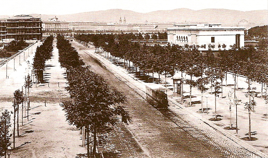
Deutsch: Der Wiener Burgring mit dem äußeren Burgtor um 1872
English: The Burgring (section of the Wiener Ringstraße) about 1872 |
|||||||||||||||||||||||
| Rana | circa 1872 | |||||||||||||||||||||||
| Masomi | Ausstellungskatalog: Blickfänge einer Reise nach Wien - Fotografien 1860-1910 - Aus den Sammlungen des Wien Museums | |||||||||||||||||||||||
| Marubucin |
|
|||||||||||||||||||||||
| Izini (Sake amfani da wannan fayil) |
|
|||||||||||||||||||||||

| Camera location | | View this and other nearby images on: OpenStreetMap |
|---|
Tarihin fayil
Ku latsa rana/lokaci ku ga fayil yadda yake a wannan lokaci
| Rana/Lokaci | Wadar sufa | Kusurwowi | Ma'aikaci | Bahasi | |
|---|---|---|---|---|---|
| na yanzu | 00:23, 8 ga Augusta, 2006 | | 901 × 532 (546 KB) | Otto Normalverbraucher | {{Information |Description=Der Wiener Burgring mit dem äußeren Burgtor um 1872 / The Burgring (section of the Wiener Ringstraße) about 1872 |Source=Ausstellungskatalog: Blickfänge einer Reise nach Wien - Fotografien 1860-1910 - Aus den Sammlungen des |
Amfani da fayil
Wadannan shafi na amfani wannan fayil:
Amfanin fayil a ko'ina
Wadannan sauran wikis suna amfani da fayil din anan
- Amfani a kan cs.wikipedia.org
- Amfani a kan da.wikipedia.org
- Amfani a kan de.wikipedia.org
- Amfani a kan eo.wikipedia.org
- Amfani a kan es.wikipedia.org
- Amfani a kan he.wikipedia.org
- Amfani a kan ka.wikipedia.org
- Amfani a kan nl.wikipedia.org
- Amfani a kan no.wikipedia.org
- Amfani a kan pl.wikipedia.org
- Amfani a kan ro.wikipedia.org
- Amfani a kan sh.wikipedia.org
- Amfani a kan sk.wikipedia.org
- Amfani a kan zh.wikipedia.org