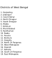
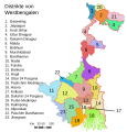
Hoton asali (Fayil kin SVG, saƙar fikisal 768 x 1,159, girman fayil: 311 KB)

Wannan hoto yazo daga Wikimedia Commons kuma za'a iya amfani dashi a wasu projects. Anan kasa an nuna asalin bayanin shi

Taƙaici

Bayani
English: Original summary by creator of base svg file deeptrivia. Districts of West Bengal

Based on https://web.archive.org/web/20040606103522/www.censusindia.net/results/2001maps/wbengal01.html

Modifications by Mouryan:

  1. upladed translated version of File:WestBengalDistricts numbered de.svg.
  2. The districts of Dakshin 24 Parganas district and Uttar 24 Parganas were incorrectly numbered in the Map. The errors have been rectified.

Modifications by Furfur:

  1. The 4 (four) new districts of West Bengal namely Paschim Bardhaman district (bifurcated from Bardhaman district), Kalimpong district (bifurcated from Darjeeling district), Alipurduar district (bifurcated from Jalpaiguri district) and Jhargram district (bifurcated from Paschim Medinipur district) has been shown in this new Updated map.

Modifications by Antorjal:

  1. Midnapore District has been bifurcated to show both Paschim Medinipur and Purba Medinipur.
  2. Numbered and listed districts per comments at peer-review.
  3. Font size reduced for clarity, since the districts are now listed.
  4. Many of the spellings did not conform to linked articles in the text. All spellings now match the West Bengal article spellings.
Rana 8 Oktoba 2006 (original upload date)
Masomi Transferred from en.wikipedia to Commons by Padawane.
Marubucin The original uploader was Antorjal at Turanci Wikipedia.
Other versions

[gyarawa]

SVG genesis
InfoField
 
The source code of this SVG is invalid due to an error.
 
This W3C-invalid map was created with Adobe Illustrator,
 
and with Inkscape.
 
 This map uses embedded text that can be easily translated using a text editor.

Lasisi

w:en:Creative Commons
Jinginarwa Yada ahaka
This file is licensed under the Creative Commons Attribution-Share Alike 2.5 Generic, 2.0 Generic and 1.0 Generic license.
Za ka iya:
  • a raba – dan kwafa, yadawa da aika aikin
  • dan maimaita – dan daukar aikin
A karkashin wannan sharuddan
  • Jinginarwa – Dole ku bada jinjina da ta dace, samar da linki zuwa lasisin, da kuma bayyana ko kunyi sauyi. Zaku iya haka ta yadda ta dace, amma ba kowace hanya ba wanda zai nuna mai-lasisin yana goyon bayan ku ba ko goyon bayan amfanin da kuke yi ba.
  • Yada ahaka – Idan kuka maimaita, sabuntawa, ko kari akan wannan, dole ku bayar da gudunmuwar ku karkashin iri daya ko lasisi data dace kamar na asali.
w:en:Creative Commons
Jinginarwa Yada ahaka
Wannan fayil ɗin an bada lasisin shi ƙarƙashin Creative Commons Attribution-Share Alike 3.0 Unported lasisi. Subject to disclaimers.
Za ka iya:
  • a raba – dan kwafa, yadawa da aika aikin
  • dan maimaita – dan daukar aikin
A karkashin wannan sharuddan
  • Jinginarwa – Dole ku bada jinjina da ta dace, samar da linki zuwa lasisin, da kuma bayyana ko kunyi sauyi. Zaku iya haka ta yadda ta dace, amma ba kowace hanya ba wanda zai nuna mai-lasisin yana goyon bayan ku ba ko goyon bayan amfanin da kuke yi ba.
  • Yada ahaka – Idan kuka maimaita, sabuntawa, ko kari akan wannan, dole ku bayar da gudunmuwar ku karkashin iri daya ko lasisi data dace kamar na asali.
This licensing tag was added to this file as part of the GFDL licensing update.
GNU head An bada damar a kofa, a yaɗa/ko sauya wannan kundi ƙarƙashin Lasisin GNU ta kyauta, Fitarwa na 1.2 ko duk wani fitarwa da zai biyo baya daga Gidauniyar Samar da Software ta Kyauta; ba tare da sauyin sashe ba, babu Rubutun Fuskar gaban shafi, kuma babu Rubutun bayan shafi. Kofi na lasisin na nan an sanya sa aciki ƙarƙashin sashen GNU Free Documentation License. Subject to disclaimers.

Original upload log

The original description page was here. All following user names refer to en.wikipedia.
  • 2006-12-25 04:28 Deeptrivia 450×500×0 (102714 bytes) Repair attempt
  • 2006-12-25 04:17 Deeptrivia 450×500×0 (101044 bytes) Repair attempt
  • 2006-10-08 14:21 Antorjal 450×500×0 (100501 bytes) Original summary by creator of base svg file [[User:deeptrivia|deeptrivia]]. Districts of West Bengal Based on http://web.archive.org/web/20040606103522/www.censusindia.net/results/2001maps/wbengal01.html Modifications by [[User:Antorjal|An
  • 2006-10-08 14:17 Antorjal 450×500×0 (100294 bytes) Original summary by creator of base svg file [[User:deeptrivia|deeptrivia]]. Districts of West Bengal Based on http://web.archive.org/web/20040606103522/www.censusindia.net/results/2001maps/wbengal01.html Modifications by [[User:Antorjal|An
  • 2006-10-08 14:15 Antorjal 450×500×0 (100501 bytes) Original summary by creator of base svg file [[User:deeptrivia|deeptrivia]]. Districts of West Bengal Based on http://web.archive.org/web/20040606103522/www.censusindia.net/results/2001maps/wbengal01.html Modifications by [[User:Antorjal|An
  • 2006-10-08 14:09 Antorjal 450×500×0 (100484 bytes) Original summary by creator of base svg file [[User:deeptrivia|deeptrivia]]. Districts of West Bengal Based on http://web.archive.org/web/20040606103522/www.censusindia.net/results/2001maps/wbengal01.html Modifications by [[User:Antorjal|An
  • 2006-10-08 14:05 Antorjal 450×500×0 (100501 bytes) Original summary by creator of base svg file [[User:deeptrivia|deeptrivia]]. Districts of West Bengal Based on http://web.archive.org/web/20040606103522/www.censusindia.net/results/2001maps/wbengal01.html Modifications by [[User:Antorjal|An

Take

Add a one-line explanation of what this file represents

Abubuwan da aka nuna a cikin wannan fayil

depicts Turanci

copyrighted Turanci

8 Oktoba 2006

media type Turanci

image/svg+xml

Tarihin fayil

Ku latsa rana/lokaci ku ga fayil yadda yake a wannan lokaci

Rana/LokaciWadar sufaKusurwowiMa'aikaciBahasi
na yanzu21:04, 25 ga Afirilu, 2020Wadar sufa ta zubin 21:04, 25 ga Afirilu, 2020768 × 1,159 (311 KB)Debjitpaul10Updated text
20:45, 25 ga Afirilu, 2020Wadar sufa ta zubin 20:45, 25 ga Afirilu, 2020768 × 1,159 (113 KB)Debjitpaul10Uploaded a corrected and transparent version.
06:15, 5 Nuwamba, 2017Wadar sufa ta zubin 06:15, 5 Nuwamba, 2017576 × 601 (144 KB)Mouryan{{Information |Description={{en|Original summary by creator of base svg file deeptrivia. Districts of West Bengal Based on http://web.archive.org/web/20040606103522/www.censusindia.net/results/2001maps/wbengal01.html Modificati...
02:51, 5 Nuwamba, 2017Wadar sufa ta zubin 02:51, 5 Nuwamba, 2017576 × 601 (144 KB)Mouryan{{Information |Description={{en|Original summary by creator of base svg file deeptrivia. Districts of West Bengal Based on http://web.archive.org/web/20040606103522/www.censusindia.net/results/2001maps/wbengal01.html Modificati...
13:59, 25 Nuwamba, 2008Wadar sufa ta zubin 13:59, 25 Nuwamba, 20081,595 × 2,256 (212 KB)GDibyendu{{Information |Description=fixed map (sunderbans), fixed district names |Source=based on locator map:West_Bengal_locator_map.svg |Date=2008-11-25 |Author=GDibyendu |Permission=All |other_versions= }}
20:30, 24 Nuwamba, 2008Wadar sufa ta zubin 20:30, 24 Nuwamba, 2008450 × 500 (100 KB)GDibyenduReverted to version as of 14:58, 17 January 2008 as some error crept in today's attempted upload
20:14, 24 Nuwamba, 2008Wadar sufa ta zubin 20:14, 24 Nuwamba, 20081,595 × 2,256 (191 KB)GDibyendu{{Information |Description=Corrected the map (it was not showing sunderbans are properly) |Source=This map is based on locator map of West Bengal (West_Bengal_locator_map.svg) |Date=2008-11-24 |Author=GDibyendu |Permission=All |other_versions= }}
17:43, 22 Nuwamba, 2008Wadar sufa ta zubin 17:43, 22 Nuwamba, 2008450 × 500 (100 KB)GDibyenduReverted to version as of 14:58, 17 January 2008
17:41, 22 Nuwamba, 2008Wadar sufa ta zubin 17:41, 22 Nuwamba, 2008450 × 500 (7 KB)GDibyendu{{Information |Description=Rewrote text in image to improve readability |Source=Based on last version |Date=2008-11-22 |Author=GDibyendu |Permission=All |other_versions= }}
14:58, 17 ga Janairu, 2008Wadar sufa ta zubin 14:58, 17 ga Janairu, 2008450 × 500 (100 KB)File Upload Bot (Magnus Manske) {{BotMoveToCommons|en.wikipedia}} {{Information |Description={{en|Original summary by creator of base svg file deeptrivia. Districts of West Bengal Based on http://web.archive.org/web/20040606103522/www.censusindia.net/results/200

Wadannan shafi na amfani wannan fayil:

Amfanin fayil a ko'ina

Wadannan sauran wikis suna amfani da fayil din anan

Duba ƙarin amfanin wannan fayil.

bayannan meta