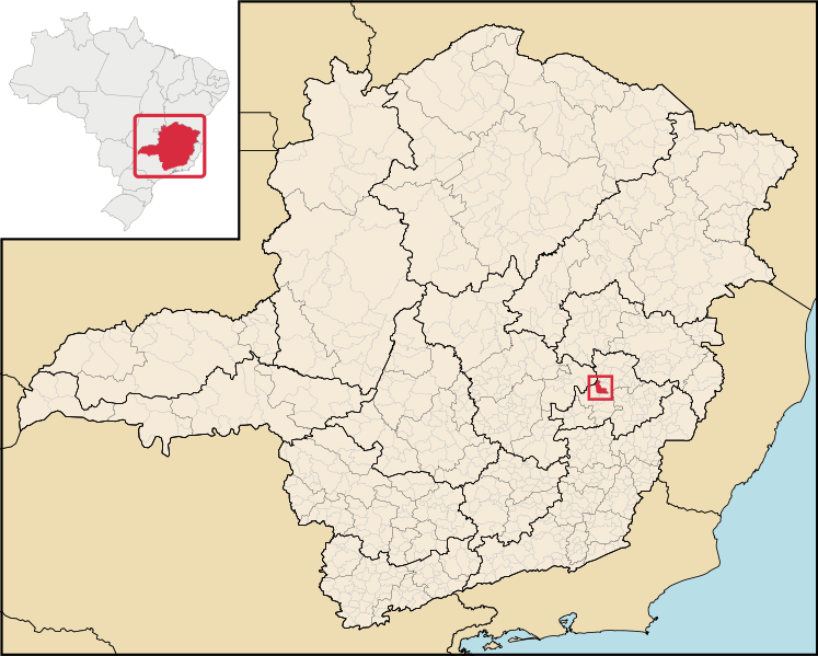
Fayil:MinasGerais Municip CoronelFabriciano.svg

Size of this PNG preview of this SVG file: 747 × 599 pixels. Wasu yarjejeniyoyi: 299 × 240 pixels | 598 × 480 pixels | 957 × 768 pixels | 1,276 × 1,024 pixels | 2,552 × 2,048 pixels | 2,147 × 1,723 pixels.
Hoton asali (Fayil kin SVG, saƙar fikisal 2,147 x 1,723, girman fayil: 2.9 MB)
Tarihin fayil
Ku latsa rana/lokaci ku ga fayil yadda yake a wannan lokaci
| Rana/Lokaci | Wadar sufa | Kusurwowi | Ma'aikaci | Bahasi | |
|---|---|---|---|---|---|
| na yanzu | 18:13, 29 ga Yuni, 2020 |  | 2,147 × 1,723 (2.9 MB) | Apollo BR | Atualização das mesorregiões e microrregiões de Minas Gerais para regiões geográficas intermediárias e regiões geográficas imediatas, respectivamente, segundo nova classificação do IBGE de 2017. Fonte: IBGE 2017 <https://www.ibge.gov.br/apps/regioes_geograficas/> Base Cartográfica: IBGE 2019 <https://www.ibge.gov.br/geociencias/organizacao-do-territorio/15774-malhas.html?=&t=downloads> Elaboração: Trabalho próprio, com o software QGIS. Formatação das camadas: MINAS GERAIS: borda= 0,66 mm... |
| 22:59, 29 Disamba 2018 |  | 914 × 709 (2.43 MB) | HVL | Removing regional division extinguished | |
| 04:45, 28 ga Augusta, 2006 |  | 914 × 709 (1.91 MB) | Raphael.lorenzeto | {{Information| |Description=Map locator of a city in Minas Gerais (this description will be changed) |Source=Image:MinasGerais MesoMicroMunicip.svg, own work |Date=August 28, 2006 |Author=Raphael Lorenzeto de Abreu |Permission={{self2|GFDL|cc-by-2.5} |
Amfani da fayil
Wadannan shafi na amfani wannan fayil:
Amfanin fayil a ko'ina
Wadannan sauran wikis suna amfani da fayil din anan
- Amfani a kan ar.wikipedia.org
- Amfani a kan bcl.wikipedia.org
- Amfani a kan bpy.wikipedia.org
- Amfani a kan ca.wikipedia.org
- Amfani a kan ch.wikipedia.org
- Amfani a kan de.wikipedia.org
- Amfani a kan en.wikipedia.org
- Amfani a kan eo.wikipedia.org
- Amfani a kan es.wikipedia.org
- Amfani a kan eu.wikipedia.org
- Amfani a kan fa.wikipedia.org
- Amfani a kan ff.wikipedia.org
- Amfani a kan fj.wikipedia.org
- Amfani a kan gl.wikipedia.org
- Amfani a kan hr.wikipedia.org
- Amfani a kan ia.wikipedia.org
- Amfani a kan id.wikipedia.org
- Amfani a kan incubator.wikimedia.org
- Amfani a kan io.wikipedia.org
- Amfani a kan it.wikipedia.org
- Amfani a kan kaa.wikipedia.org
- Amfani a kan ko.wikipedia.org
- Amfani a kan la.wikipedia.org
- Amfani a kan lg.wikipedia.org
- Amfani a kan ms.wikipedia.org
- Amfani a kan mt.wikipedia.org
- Amfani a kan mwl.wikipedia.org
- Amfani a kan nl.wikipedia.org
- Amfani a kan nov.wikipedia.org
- Amfani a kan no.wikipedia.org
- Amfani a kan oc.wikipedia.org
- Amfani a kan pt.wikipedia.org
- Amfani a kan pt.wikibooks.org
- Amfani a kan ro.wikipedia.org
- Amfani a kan sh.wikipedia.org
- Amfani a kan simple.wikipedia.org
- Amfani a kan sm.wikipedia.org
- Amfani a kan ss.wikipedia.org
- Amfani a kan sv.wikipedia.org
- Amfani a kan tt.wikipedia.org
- Amfani a kan uk.wikipedia.org
- Amfani a kan vi.wikipedia.org
- Amfani a kan vo.wikipedia.org
Duba ƙarin amfanin wannan fayil.
