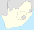
Fayil:Map of South Africa with provincial borders 1976-1994.svg

Size of this PNG preview of this SVG file: 684 × 599 pixels. Wasu yarjejeniyoyi: 274 × 240 pixels | 548 × 480 pixels | 876 × 768 pixels | 1,168 × 1,024 pixels | 2,337 × 2,048 pixels | 809 × 709 pixels.
Hoton asali (Fayil kin SVG, saƙar fikisal 809 x 709, girman fayil: 389 KB)
Tarihin fayil
Ku latsa rana/lokaci ku ga fayil yadda yake a wannan lokaci
| Rana/Lokaci | Wadar sufa | Kusurwowi | Ma'aikaci | Bahasi | |
|---|---|---|---|---|---|
| na yanzu | 17:19, 7 ga Maris, 2011 |  | 809 × 709 (389 KB) | Htonl | {{Information |Description ={{en|1=Blank map of South Africa, with the provincial boundaries as they were from 1976 (when Griqualand East was transferred from the Cape to Natal) to 1994 (when entirely new provinces were established). Projection: Lamber |
Amfani da fayil
Babu shafuka da suke amfani da fayil din nan.
Amfanin fayil a ko'ina
Wadannan sauran wikis suna amfani da fayil din anan
- Amfani a kan he.wikipedia.org
