Fayil:Map of South Africa with Cacadu highlighted (2011).svg

Size of this PNG preview of this SVG file: 684 × 599 pixels. Wasu yarjejeniyoyi: 274 × 240 pixels | 548 × 480 pixels | 876 × 768 pixels | 1,168 × 1,024 pixels | 2,337 × 2,048 pixels | 809 × 709 pixels.
Hoton asali (Fayil kin SVG, saƙar fikisal 809 x 709, girman fayil: 498 KB)
.svg)
Taƙaici
| Bayani |
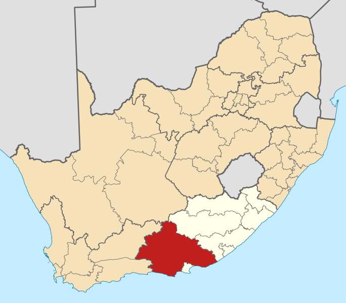
English: Map of district boundaries in South Africa, as they will be after the municipal elections of 18 May 2011, with the w:Cacadu District Municipality highlighted in red within the Eastern Cape in yellow. |
| Rana | |
| Masomi | Aikin na |
| Marubucin | Htonl |
Lasisi
I, the copyright holder of this work, hereby publish it under the following licenses:

|
An bada damar a kofa, a yaɗa/ko sauya wannan kundi ƙarƙashin Lasisin GNU ta kyauta, Fitarwa na 1.2 ko duk wani fitarwa da zai biyo baya daga Gidauniyar Samar da Software ta Kyauta; ba tare da sauyin sashe ba, babu Rubutun Fuskar gaban shafi, kuma babu Rubutun bayan shafi. Kofi na lasisin na nan an sanya sa aciki ƙarƙashin sashen GNU Free Documentation License. |
This file is licensed under the Creative Commons Attribution-Share Alike Attribution-Share Alike 4.0 International, 3.0 Unported, 2.5 Generic, 2.0 Generic and 1.0 Generic license.
- Za ka iya:
- a raba – dan kwafa, yadawa da aika aikin
- dan maimaita – dan daukar aikin
- A karkashin wannan sharuddan
- Jinginarwa – Dole ku bada jinjina da ta dace, samar da linki zuwa lasisin, da kuma bayyana ko kunyi sauyi. Zaku iya haka ta yadda ta dace, amma ba kowace hanya ba wanda zai nuna mai-lasisin yana goyon bayan ku ba ko goyon bayan amfanin da kuke yi ba.
- Yada ahaka – Idan kuka maimaita, sabuntawa, ko kari akan wannan, dole ku bayar da gudunmuwar ku karkashin iri daya ko lasisi data dace kamar na asali.
Ku na iya zaɓan lasisin da kuke so.
Tarihin fayil
Ku latsa rana/lokaci ku ga fayil yadda yake a wannan lokaci
| Rana/Lokaci | Wadar sufa | Kusurwowi | Ma'aikaci | Bahasi | |
|---|---|---|---|---|---|
| na yanzu | 13:59, 2 Mayu 2011 | | 809 × 709 (498 KB) | Htonl | == Summary == {{Information |Description ={{en|1=Map of district boundaries in South Africa, as they will be after the municipal elections of 18 May 2011, with the w:Cacadu District Municipality highligh |
Amfani da fayil
Wadannan shafi na amfani wannan fayil:
Amfanin fayil a ko'ina
Wadannan sauran wikis suna amfani da fayil din anan
- Amfani a kan af.wikipedia.org
- Nieu-Bethesda
- Grahamstad
- Bathurst, Oos-Kaap
- Port Alfred
- Graaff-Reinet
- Aberdeen, Oos-Kaap
- Adendorp
- Somerset-Oos
- Joubertina
- Boesmansriviermond
- Humansdorp
- Willowmore
- Pearston
- Riebeek-Oos
- Jansenville
- Steytlerville
- Hankey
- Patensie
- Kookhuis
- Jeffreysbaai
- Kareedouw
- Klipplaat
- Kirkwood
- Alicedale
- Kruisfontein
- Paterson
- Stormsrivier, Oos-Kaap
- Loerie
- Kendrew
- Kenton-on-Sea
- Alexandria, Oos-Kaap
- Stormsrivier
- Addo
- Louterwater
- Krakeelrivier (dorpie)
- Salem, Oos-Kaap
- St. Francisbaai
- Clarkson
- Thornham
- Coldstream
- Rietbron
- Misgund
- Tweeriviere
- Kaap St Francis
- Oesterbaai
- Sjabloonbespreking:Suid-Afrikaanse distriksmunisipaliteit navbox
- Cannon Rocks
- Boknesstrand
- Kasouga
- Thornhill, Kouga
Duba ƙarin amfanin wannan fayil.
.svg)
.svg)