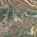
Fayil:Flooding near the Betsiboka River, Madagascar 2010-03-23 lrg.jpg

Yanayin wannan rigayi gani: 600 × 600 pixels. Wasu yarjejeniyoyi: 240 × 240 pixels | 480 × 480 pixels | 768 × 768 pixels | 1,024 × 1,024 pixels | 2,048 × 2,048 pixels | 3,000 × 3,000 pixels.
Hoton asali (pikisal 3,000 × 3,000, girman fayil: 5.34 MB, irin MIME: image/jpeg)
Tarihin fayil
Ku latsa rana/lokaci ku ga fayil yadda yake a wannan lokaci
| Rana/Lokaci | Wadar sufa | Kusurwowi | Ma'aikaci | Bahasi | |
|---|---|---|---|---|---|
| na yanzu | 00:53, 26 ga Janairu, 2013 |  | 3,000 × 3,000 (5.34 MB) | Slick-o-bot | Bot: convert to a non-interlaced jpeg (see bug #17645) |
| 00:50, 26 ga Maris, 2010 |  | 3,000 × 3,000 (5.04 MB) | Captain-tucker | {{Information |Description={{en|In northwestern Madagascar, the Betsiboka River flows toward the coast, its braided streams emptying into the Bombetoka Bay. In late March 2010, however, not long after Tropical Cyclone Hubert passed through the region, par |
Amfani da fayil
Wadannan shafi na amfani wannan fayil:
Amfanin fayil a ko'ina
Wadannan sauran wikis suna amfani da fayil din anan
- Amfani a kan en.wikipedia.org
- Amfani a kan fr.wikipedia.org


